


Cala Llonga, La Mola, Morts, Mesquida

Surely, it is the beach most visited by young people from Mahón. The beach is wide with fine, golden-leaning sand and is shallow, to the point that cars can be left on the sand itself, 50 meters from the coast. The beach is divided into three parts: the first, larger one, is for the general public and families; followed by a much smaller area separated by a 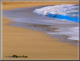 large rock in the same line as the sea, which is used by those who come in the morning to spend the whole day and take advantage of the rock slope to set up a picnic. In the past, you could see caravans, but it was prohibited and none have been seen there for more than ten years.
Further to the right, just under the large tower ("Torre de los Ingleses" in reference to the conquering army of Menorca that built it), there is another small beach separated by a breakwater where the mountain begins and continues until it enters the water and 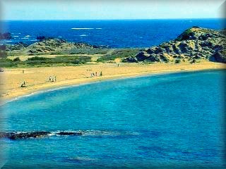 acts as a clear separation. There is a small area of the beach that is used by nudists, just before which there is a transition zone. In any case, topless bathing has been practiced on all beaches in Menorca for many years, and the coexistence of nudists and those wearing swimsuits is very high on most of the beaches and coves of Menorca
La Mesquida beach:
Although protected, given that it points towards the interior of the large inlet where the beach and the La Mesquida residential area are located, the beach itself is open to the sea and gets deep a short distance from the breaking waves. The sand is fine and grey in color; the stone in the area includes black slate.
The Tower of the English:
Another defense tower, another bunker, of which there are several all along the coast of Menorca, visible from everywhere in Cala Mesquida,
In total, in Menorca there are eleven coastal defense towers that were built between 1798 and 1802 during the various dominations that Menorca had at the hands of the armies of England, France, and the ruling monarchs of the Iberian Peninsula.
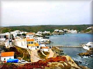
The La Mesquida residential area is about a kilometer away and is a collection of small houses, mostly belonging to Menorcans. It has a small jetty right next to the freshwater stream, a bar in the village, and a renowned restaurant on the hill with unbeatable views of La Mesquida, the beach, and the cliff
Es Murtar :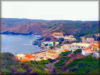
A small residential area for Menorcans, the first or the last depending on how you look at it, in this part of the coast. It has a small beach and a jetty in addition to the pier with the small boats of the local residents. It has almost no services as it is not a tourist area.
Excursions:
You can climb to the watchtower "Es Pla Gros", which is the hill on the opposite side of the defense tower at the beach of La Mesquida. You will be able to enjoy its magnificent views; the slope is not very steep and it takes about 20 minutes.
Other walks are in the opposite direction to the watchtower, but always along the coast. The first thing we find is a pebble beach, and you can climb up to the edge of the cliff.
 Cala Llonga :
The other side of the extraordinary Port of Maó
Cala Llonga is an important residential area of high-priced villas, many of them enviable, not only for their value or large dimensions, but for their views. Located on the banks of the port of Mahón and around the largest but least urbanized cove in the port, it has hotels and aparthotels, but above all houses and villas intended for private accommodation or tourist rentals for those with high purchasing power, especially in the summer season.
It has several piers, docks, and mooring areas, on the coast or at free anchor.
Although the bank of the port has many small urban centers or isolated houses, all of which have a small pier and some a jetty, the cove area is where the greatest number of nautical and commercial activities are concentrated. Even though the cove is mainly residential, both by foreigners and Menorcans—some of whom only use them for weekends or as a bedroom for Mahón residents who have their habitual residence on the other side of the port due to the proximity but spend the day in the city—a visit is recommended, as is taking a long walk to enjoy the best views of the port of Mahón, even if you prefer to do so without getting out of your vehicle.
Along the access road, at the second entrance to the Cala Llonga residential area (there are three), right at the curve there is a path that leads to the coast. The landscape is interesting, and just below is a cove, "Cala d'en Mora", with a narrow beach of coarse black sand, just like the stones that surround it, including Cap Negre. To the left, you can see the small residential area of Es Murtar.
 La Mola de Maó :
It is an area with large military installations, barracks, bunkers, and watchtowers, and the famous artillery area that has two other large cannons like the ones we can see in Llucalari. The site can be visited, but you must obtain permits in advance. This place, specifically at the S'Esperó headland, is where the first sun of the Kingdom of Spain rises; it is the easternmost point of current Spanish territory. The area of La Mola is almost an island, as it is joined to the rest by only a narrow and short strip of land where the sea almost gives the feeling that it will touch itself at the entrances formed by the coves of Es Freus and Taulera, less than one hundred meters wide, which also geologically divides La Mola from this area of the Menorcan coast that, from here on, is made of black slate and reaches Cabo de Favàritx. From La Mola and its surroundings, there are unbeatable views of the island of Lazareto, a vacation center of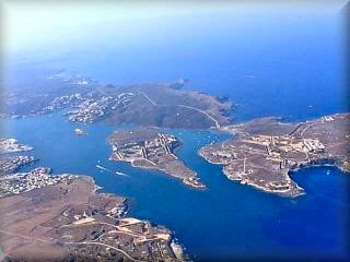 the Ministry of Health of the Spanish government.
Access:
Taking the Me 3 road that starts at the roundabout right at the end of the Port of Maó.
If you come from the port, upon reaching the roundabout, the Me 3 is the one on the right just at the end of the Port of Maó. If you come from the roundabout of the main road (Me 1) that connects Maó with Ciutadella, you must pass the roundabout and continue straight, heading into the back of the Port of Maó. The first thing you will find is the turnoff to Cala Llonga, La Mola, and Cala Mesquida; it is right at the building of the electric company GESA. To the left is our path, to the right is the cargo pier, a dry marina for large ship repairs, and the entrance to the Spanish Army naval base.
Take the left, passing behind the electric company plant. The first entrance on the right is to Cala Rata, a residential area on the coast of the Port of Maó
We continue; the next turnoff to the left is the entrance to the Sant Isidre military base, a restricted military area
The next entrance on the right is San Anton; we continue straight
Now the next exit on the left is for Cala Es Murtar and La Mesquida. From here on the map of the coast of La Mesquida, we follow the points starting from the turnoff indicated with (2), the paths for each side of the cove; the second turnoff now to the right is for Es Murtar and to the left is the one that takes us to the beach, 2 km. The Me 3 is the end of the road and it has a parking lot
Access map to Es Murtar and Cala Mesquida

1) Road to Mahón or Cala Llonga and La Mola
2) Turn right to Es Murtar, straight on to La Mesquida
3) Es Murtar
4) Restaurant with beautiful views of Cala Mesquida
5) Town of Cala Mesquida
6) Parking for Cala Mesquida beach
7) Tower of the English, coastal defense bunker
8) Cala Mesquida beach
9) Beach area for naturism, nudism
Copyright Islademenorca.es, total or partial reproduction of the content of this portal is prohibited
Photographs: Omar Mauro Banquero